
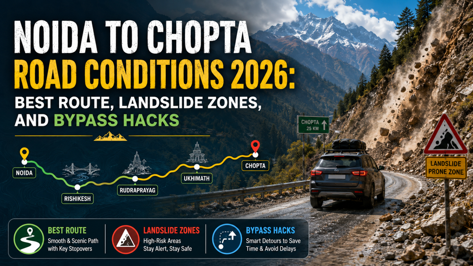
Planning a driving or riding trip from Delhi NCR to mini-Switzerland? Read our definitive 3,000-word Noida to Chopta road condition manual for 2026. Master the Meerut speed limits, Srinagar bypass shortcuts, and high-risk Ukhimath landslide zones.
1. The Urban-to-Alpine Transition: Introduction to Noida to Chopta Road Realities
Escaping the commercial hum drum of Noida Sector 62, the glass towers of Noida Sector 132, or the wide lanes of Greater Noida Expressway to touch the untouched alpine meadows of Chopta Tungnath is the ultimate getaway for adventure seekers in Delhi NCR. Sitting at a crisp altitude of 2,680 meters (8,790 feet) inside the Kedarnath Wildlife Sanctuary, Chopta is fondly called the “Mini Switzerland of India.” However, navigating the ~430-kilometer transit isn’t a simple flat highway cruise. It is a highly dynamic transition from multi-lane expressways in western Uttar Pradesh to the narrow, crumbling mountain ledges of the Rudraprayag and Ukhimath sub-alpine corridors.
When travelers search for the Noida to Chopta road condition in 2026, they are trying to manage unpredictable ground logistics. The deployment of the massive Char Dham All-Weather Road project has drastically streamlined major chunks of National Highway 58 (NH-58), bypassing structural chokepoints that used to cause 4-hour traffic blocks. Yet, high-altitude road work is an ongoing battle against gravity. Sudden cloud density shifts, unexpected rockfalls near vulnerable fault lines, and active bottleneck construction patches past Rishikesh mean that your route selection requires real tactical calculation. At DreamTripGuide, we treat road tripping as a system of mechanical and logistical prep. Whether you are driving an SUV with a low profile or riding a neo-retro urban motorcycle, this 3,000-word comprehensive manual will prepare you for changing tarmac qualities, speed traps, and bottleneck bypass routes.
🏔️ Kedarnath Yatra Checklist 2026: 12 Must-Have Items for a Successful Trek

- ✅Altitude Protection: Prevents breathlessness and headaches caused by low oxygen levels at Kedarnath top.
- ✅Instant Energy: Helps you recover faster during the steep 16km trek from Gauri Kund.
- ✅Lightweight: Fits easily in your side pocket and weighs almost nothing.

- ✅Unbeatable Grip: Anti-skid soles designed specifically for slippery mountain rocks and mud.
- ✅100% Waterproof: Keeps your feet dry during sudden rains or while crossing small streams.
- ✅Ankle Support: Prevents injuries on the uneven zig-zag paths of the Kedar valley.

- ✅Total Coverage: Covers you and your large backpack completely during heavy mountain rains.
- ✅Quick Dry: Much better than heavy raincoats; it's light and dries in minutes.
- ✅Windproof: Blocks the freezing cold winds that follow the rain at high altitudes.

- ✅Heat Retention: Advanced fabric that locks body heat even when the temperature drops to 0°C.
- ✅Odour Resistant: Can be worn for multiple days without feeling unhygienic.
- ✅Slim Fit: Fits comfortably under your regular clothes without looking bulky.

- ✅Cold Protection: Battery dies fast in cold weather; this ensures your phone stays alive for photos.
- ✅Massive Capacity: Charge your phone and camera 4-5 times fully during the trip.
- ✅Fast Charging: Don't waste time at charging points in tea stalls.

- ✅Knee Support: Reduces 25% of the pressure on your knees during the steep descent.
- ✅Better Balance: Essential for crossing slippery patches or walking in narrow trails.
- ✅Anti-Shock: Absorbs ground impact to prevent wrist and shoulder pain.

- ✅12H Hot: Keep hot water/tea ready to fight the freezing cold of the Himalayas.
- ✅BPA Free: Safe and healthy stainless steel that won't rust.
- ✅Strong Body: Survives accidental drops on rocky terrains easily.

- ✅Mountain Ready: Contains pain sprays, bandages, and altitude sickness tablets.
- ✅Lightweight: Small enough to fit in any backpack side pocket.
- ✅Must Have: Medical help is far away on the trek; be your own first responder.
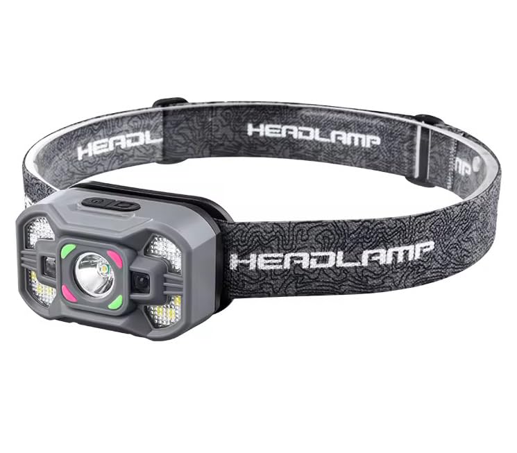
- ✅Hands-Free: Essential for early morning treks (3 AM) so you can use trekking poles freely.
- ✅High Brightness: Powerful beam that covers up to 100 meters clearly.
- ✅Weatherproof: Continues to work even during rain or heavy mist.
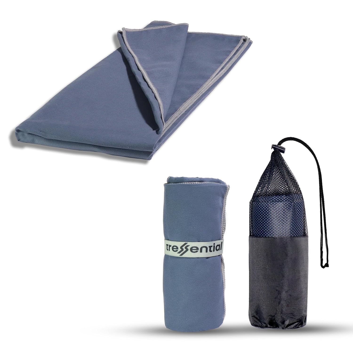
- ✅No Wet Smell: Dries in minutes so you don't carry a heavy, smelly towel in your bag.
- ✅Super Tiny: Folds into a small pouch, leaving more room for warm clothes.
- ✅Gentle: Ultra-soft fabric that is perfect for cold weather skin care.

- ✅High Altitude Protection: Himalayan sun is harsh and causes severe tanning & burns.
- ✅Non-Greasy: Doesn't feel oily while trekking or sweating.
- ✅Sweat Resistant: Stays on your skin even during high-intensity walking.

- ✅Dual Protection: Ponchos are good, but this ensures no water enters your bag.
- ✅Reflective Logo: Helps others see you in heavy mist or night treks.
- ✅Universal Fit: Fits perfectly on all 30L to 60L trekking backpacks.
2. The Route Architecture: Speed Limits, Srinagar Bypass & Tarmac Quality Grid
The run from Noida to Chopta is divided into three distinct driving zones: the Plain Expressway Stretch (Noida to Rishikesh), the Winding River Valley Highway (Rishikesh to Rudraprayag), and the Extreme Narrow Mountain Stretch (Rudraprayag to Chopta via Ukhimath).
The major highlight of 2026 is the Srinagar Bypass Hack. Previously, entering Srinagar city meant fighting heavy local market traffic and school buses, draining 45 minutes of fuel and clutch life. The newly activated bypass routes allow you to skim over the outer banks of the Alaknanda River seamlessly. However, speed optimization on the plain stretch requires high discipline due to strict automatic speed cameras installed along the Delhi-Meerut Expressway (NE-3).
📊 Noida to Chopta 2026 Sector-Wise Route Analysis
| Route Segment & Highway | Real-World Tarmac Quality | Admin Speed Limits (2026) | Crucial Bottlenecks & Hazards | Strategic Hack / Pro-Tip |
| Noida to Meerut Bypass (NE-3 Expressway Corridor) | 100% Smooth Concrete, Flawless Multi-lane | Car: 100 KM/H Bike: 80 KM/H | High-frequency automatic speed laser traps near Bhojpur. | Keep a strict eye on cruise control; speed fines are instantly sent to your mobile. |
| Meerut to Rishikesh (NH-58 Plain Corridor) | 4-Lane Smooth Asphalt, Intermittent Diversions | Mixed: 60 – 80 KM/H | Heavy local tractor rush near Muzaffarnagar and Roorkee. | Take the outer Roorkee bypass to avoid city center gridlocks. |
| Rishikesh to Rudraprayag (NH-58 Mountain Corridor) | Broadened All-Weather Asphalt; mostly smooth | Winding: 40 – 50 KM/H | Active shooting stone zones near Byasi and Atali. | Use the new Srinagar Bypass to completely skip town-center local markets. |
| Rudraprayag to Chopta (Via Ukhimath State Highway) | Highly Narrow, Single-lane patches, broken sections | Extreme: 25 – 35 KM/H | Massive vertical drops, un-paved edges near Sari village link. | Avoid driving past Rudraprayag after 6:00 PM; black ice sets on roads in late autumn. |
3. The Clearance & Safety Box: High-Risk Landslide Zones & Accessory Guide
As you branch off from the main NH-58 past the historical town of Rudraprayag, the terrain morphs drastically. The road shifts into a state highway format, looping through baseline fault points that are highly prone to sudden, unannounced geological activities.
The prime structural risk zone is the Kaliasaur and Sirobagarh stretch on the main highway, along with the narrow, blind hairpins past Ukhimath. During brief rainy spells, these sectors experience flash mudflows and shooting stones that tumble down from loose overhanging shale strata. Furthermore, as you cross the Chopta forest checkpoint at dusk, the rapid sub-alpine temperature drops cause sudden, dense fog walls to roll over the road lanes, dropping your real horizontal visibility to less than 2 meters.
📦 Focus: Mountain Vision & Visibility Optimization Kit
| High-Altitude Road Hazard | Critical Accessory Upgrade | Why this Protects Your Vehicle & Life |
| Sudden Dense Fog Walls past Ukhimath Forest Checkpoint | Dual-Color High-Lux Auxiliary LED Fog Lights | Stock vehicle headlights bounce off thick alpine fog sheets, blinding the driver. Yellow LED projection slices through fog particles, lighting up the un-barricaded tarmac edges. |
| Internal Helmet Fogging due to Cold Air (Breathe Condensation) | Pinlock-70 Anti-Fog Visor Lens | The intense temperature difference between your warm breath and the freezing mountain air fogs up your visor instantly, forcing you to ride with an open visor in freezing weather. |
| Loose Flying Sharp Slate Stones from Overhanging Cliffs | Heavy-Duty Polycarbonate Underbelly Guard / Bash Plate | Sharp rocks can puncture a car’s oil sump or damage a bike’s crankcase, leaving you stranded in a network-blind forest zone with an expensive repair bill. |
4. Pros and Cons: Self-Driving via Private Vehicle vs. Public Transit Group Tours
Taking your own machine gives you raw freedom over the mountain passes, but it introduces distinct physical vulnerabilities compared to booking structured group packages.
Self-Driving / Riding via Private Vehicle
- Pros: Complete freedom to stop for landscape photography near Devprayag; ease of carrying heavy winter layering gear bags; liberty to change your destination toward Sari Village or Deoriatal dynamically.
- Cons: Massive physical driver fatigue over 12 hours of constant gear shifting; absolute financial risk of tyre wall tears or underbelly scrapes; responsibility of handling mechanical breakdowns in network-blind areas.
Public Transit / Organized Group Packages
- Pros: Zero driving fatigue; experienced local mountain drivers handle the narrow hairpins easily; cost-efficient when traveling solo or as a couple.
- Cons: Rigid schedules that don’t let you explore offbeat side paths; limited space for packing personal gear bags; dependance on the group’s general pace.
Expert Review: “Saurav, driving from Noida to Chopta is a pure test of your vehicle’s cooling system and your own visual tracking stamina. The Sirobagarh and Ukhimath links are geologically volatile; they don’t give you a second chance if you make a mistake on a blind curve. If you are handling a manual transmission car, keep your tire wall condition pristine and ensure your vehicle’s brake fluid levels are topped off. Shifting your transmission to lower gear ratios (Engine Braking) down from Chopta camp lines is mandatory to keep your brake discs from overheating.” — Saurav Pal, Chief Logistics & Road Operations Consultant, DreamTripGuide.
5. Critical Road Dos and Don’ts for the Chopta Circuit
What to Do (Kya Karein):
- DO Maintain the Left Wall Lane on Blind Left Turns: Mountain trucks and local utility utility jeeps tend to drift over the center line on blind mountain loops. Hug your side closely and sound your horn continuously before every blind turn.
- DO Clear the Plains Stretch Before 6:00 AM: Cross the Noida-Ghaziabad bottleneck early. Leaving at 4:30 AM allows you to cross the busy plain industrial towns of Meerut, Muzzafarnagar, and Roorkee before local traffic blocks the roads.
- DO Rely on Low-Gear Engine Braking on Descents: While driving down from Chopta to Rudraprayag, keep your car in 2nd or 3rd gear without coasting in neutral. Allowing engine compression to control vehicle weight keeps your brakes fresh and responsive.
- DO Keep Cash Handy for Toll Plazas: While FASTag works flawlessly up to Rishikesh, network drops at high altitudes can make digital toll scans slow. Keep physical small notes ready for state environment entry fees near forest checkposts.
What NOT to Do (Kya Na Karein):
- DON’T Overtake on the Right Side of Heavy Mountain Trucks on Hairpins: Large multi-axle trucks have massive blind spots on their sides. Wait patiently until the truck driver waves his hand or gives an indicator signal before you make your move.
- DON’T Park Your Vehicle Directly Under Hanging Mud Cliffs: If you stop for a quick tea break past Srinagar, look up. Avoid areas with loose soil or hanging trees, as shifting stone fragments drop constantly from these cliffs.
- DON’T Use High-Beam Headlights in Thick Alpine Fog: High beams reflect straight off the water droplets in fog, creating a blinding white wall in front of you. Shift to low beams and activate your low-mounted yellow auxiliary fog lights instead.
- DON’T Brake Hard on Sudden Gravel Patches near Sari Link: The roads near the Sari Village link often have fine stone dust and loose gravel. Braking hard on these patches will lock your wheels instantly, leading to a dangerous skid.
6. Advanced High-Altitude Driving Mechanics: Suspension & Fuel Optimization
When ascending the grueling mountain gradients past Ukhimath toward Chopta, your vehicle encounters two major environmental challenges: dropping atmospheric pressure and sudden structural changes in the road surfaces.
- Fuel Optimization Secrets: The thin air at high altitudes means less oxygen entering your engine’s combustion chamber. For non-turbocharged cars or small-capacity bikes, this leads to a minor drop in performance. To tackle this, don’t press the accelerator pedal hard in high gears (lugging). Instead, downshift immediately to a lower gear to keep your engine revving in its prime powerband. This keeps your fuel economy optimized and prevents your engine from overheating.
- Suspension Management Over Broken Patches: The final 30 kilometers near Chopta features sections with rough stone paths and unpaved shoulders. If you are driving a sedan or a hatchback with a full load of passengers and luggage, go incredibly slow. Cross deep ruts at an angle (diagonally) to gain that vital micro-clearance window under your engine block, protecting your vital engine parts from scraping.
7. People Also Ask (PAA) – Noida to Chopta Road Conditions
- What is the current road condition from Noida to Chopta in 2026? The road is excellent up to Rudraprayag via the broad All-Weather Highway, but shifts to a narrow state highway layout past Ukhimath with some rough patches.
- Which is the safest route to drive from Noida to Chopta? The standard and most optimized route is Noida → Meerut (NE-3) → Roorkee → Haridwar → Rishikesh → Srinagar Bypass → Rudraprayag → Ukhimath → Chopta.
- Is it safe to drive to Chopta during evening or night hours? No, driving past Rudraprayag after 6:00 PM is highly dangerous due to lack of streetlights, sudden thick fog walls, and risk of stray wildlife crossings.
- How can I avoid traffic gridlocks in Srinagar city on the way? Look out for the newly opened Srinagar Highway Bypass links right before entering the main town; it allows you to cross the river bank cleanly.
- What are the speed limits on the Noida-Meerut Expressway segment? The absolute electronic speed limit for cars is 100 KM/H, and for motorcycles, it is 80 KM/H. Speed cameras are highly active.
- Do normal hatchbacks and sedans have enough clearance for Chopta? Yes, normal hatchbacks can scale Chopta easily if you drive carefully over broken patches near Sari Village and cross tall speed breakers diagonally.
- Are auxiliary fog lights mandatory for a bike trip to Chopta? While not legally mandatory, they are crucial for safety if you encounter sudden thick sub-alpine fog near the forest checkpoints.
- What should I do if my brakes start fading or smelling hot on mountain slopes? Pull over safely to a flat shoulder zone immediately. Let your brakes cool down naturally for 20 minutes; never throw cold water on hot brake discs as it will warp the metal.
- Is mobile network data available for GPS navigation throughout the route? Jio and Airtel work well up to Ukhimath, but data signals drop significantly inside the Chopta forest loop. Always download your Google Maps offline beforehand.
- Where can I track live landslide or roadblock alerts for the Chopta circuit? We map real-time highway status updates and government road clearance bulletins across our digital channels.
Prep Your Machine, Master the Curves!
Driving from the urban landscape of Noida to the misty mountains of Chopta is an incredible adventure that tests both your driving skills and your vehicle’s prep. Install your safety accessories early, understand your clearance math, and stay connected with our community maps:
👉 Instagram: @dreamtripguide.india
👉 Himalayan Road Trip Hub: www.dreamtripguide.com
