
The Indian Himalayas host numerous magnificent mountain passes, but few balance raw alpine beauty with spiritual resonance as perfectly as the Chopta Tungnath Chandrashila trek. Revered as the “Mini Switzerland of Uttarakhand,” the picturesque Chopta hill station serves as the launching pad for this legendary summit.
Whether you are looking for an action-packed chopta adventure trip, planning a chopta couple trip amidst pristine meadows, or structuring a chopta family trip, having precise logistical data is the secret to an effortless mountain experience.
As a leading digital Travel guide blog, we at Dream Trip Guide have created this definitive handbook. It covers exact geographical metrics, trail blueprints, seasonal weather shifts, and budget mapping to help you safely conquer the majestic Chandrashila peak.
1. Quick Facts & Geographical Dimensions
Navigating high-altitude Himalayan terrain demands exact geographical awareness. The regional topography gains elevation rapidly from the lush meadows of the Chopta valley up to the windswept crags of the summit.
| Geographic Milestone | Elevation (Meters) | Elevation (Feet) | Significance |
| Chopta Hill Station | $2,680\text{ m}$ | $8,792\text{ ft}$ | Trek base camp, often called the mini Switzerland Uttarakhand. |
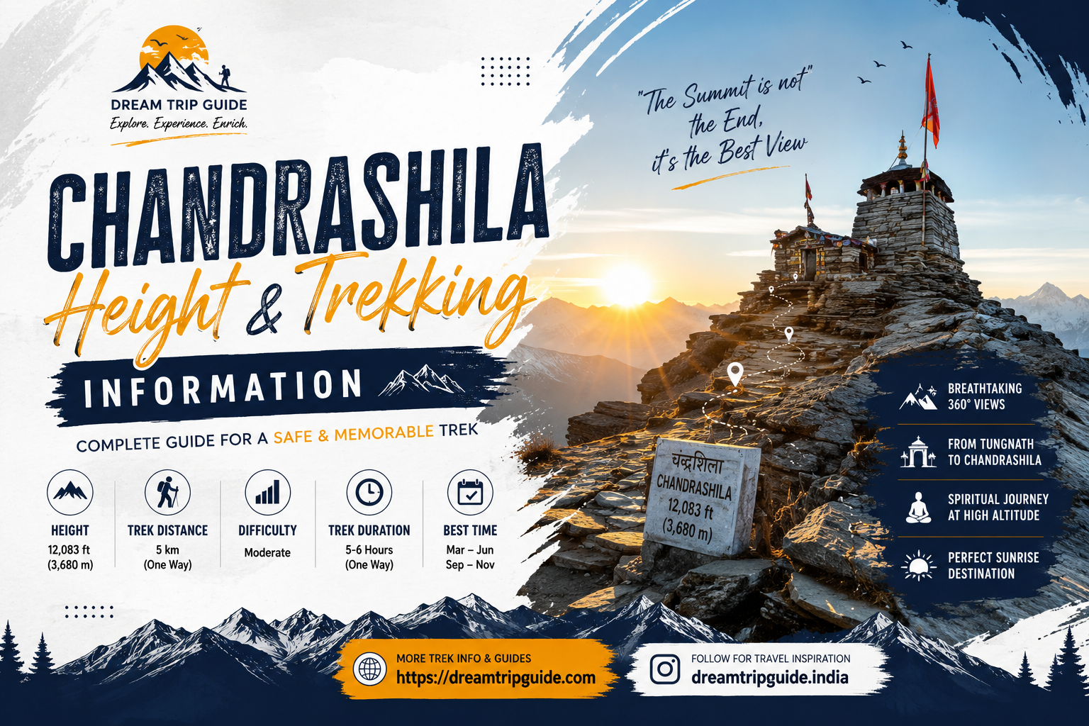
| Tungnath Mandir | $3,680\text{ m}$ | $12,073\text{ ft}$ | The highest ancient Shiva temple in the world (Tritiya Kedar). |
| Chandrashila Peak | $4,000\text{ m}$ | $13,123\text{ ft}$ | Ultimate summit offering a 360-degree Himalayan panorama. |
Understanding the chandrashila peak height is vital for pacing your ascent. At an absolute chandrashila altitude of $4,000\text{ meters}$, the atmospheric pressure drops, meaning acute acclimatization protocols should be practiced by pacing your climb smoothly.
2. Complete Trekking Distance & Route Blueprints
The core chopta trekking experience is structurally divided into two distinct phases. The entire chandrashila trek distance spans a $5\text{ km}$ uphill climb from the road-head at Chopta.
Phase 1: Chopta to Tungnath Distance
- Distance: $3.5\text{ km}$ (One Way)
- Trail Grade: Moderate, stone-paved pathway with gradual, clean switchbacks.
- Time Required: 2 to 3 hours depending on physical fitness.
The trail begins directly inside the protected forests of the Kedarnath Wildlife Sanctuary. It cuts through deep blankets of crimson rhododendrons and thick oak groves before opening up into the vast chopta valley view point clearings.
Phase 2: Tungnath to Chandrashila Trek Distance
- Distance: $1.5\text{ km}$ (One Way)
- Trail Grade: Steep, rocky, unpaved ridge climb.
- Time Required: 45 minutes to 1.5 hours.
This is where the real challenge lies. The tungnath to chandrashila distance is short but presents a sharp vertical incline. During winter, this section requires technical microspikes due to hard ice accumulations.
The Classic Addition: Deoria Tal Trek Distance
For an optimal chandrashila deoriatal trek experience, many trekkers choose to begin their journey at Sari Village, located approximately $20\text{ km}$ before Chopta.
- Sari Village to Deoria Tal: $2.3\text{ km}$ steep rocky trail.
- Highlight: A pristine lake reflecting the massive Chaukhamba peaks, making it an essential component of a comprehensive deoriatal chandrashila trek package.
3. How to Reach Chopta: Regional Transport Logistics
Reaching the chopta mini switzerland area involves traversing well-maintained but winding mountain highways. Most itineraries originate from major transit centers in North India.
[Delhi] ---> (~215 km National Highway) ---> [Rishikesh] ---> (~200 km Hill Road via NH 58) ---> [Ukhimath] ---> (~29 km) ---> [Chopta]
Delhi to Chopta Road Trip
The total driving distance from delhi to chopta is roughly $455\text{ km}$. Travelers typically split the journey by taking an overnight halt in Rishikesh or Rudraprayag to avoid driving long hours continuously on winding mountain terrain.
Rishikesh to Chopta Route Options
The rishikesh to chopta journey covers roughly $210\text{ km}$ via the main Badrinath Highway (NH 58). You will pass through major confluences including Devprayag and Rudraprayag before turning toward Ukhimath. The ukhimath to chopta distance is exactly $29\text{ km}$, offering a beautiful drive through dense alpine alpine canopies.
Important Transit Connections
- Chopta to Rishikesh Distance: $210\text{ km}$ (Approx. 7–8 hours drive).
- Chopta to Kedarnath Distance: Approximately $85\text{ km}$ by road from Chopta to Sonprayag (the base for the Kedarnath trek).
4. Curated Chopta Itinerary & Travel Planning Guide
To maximize your experience, we recommend balancing your trek with overnight camping to capture golden hour panoramas at the primary chopta photography spots.
The Perfect 4-Day Chopta Weekend Trip Blueprint
1.Arrival & Acclimatization at Deoria Tal:Day 1.
Drive from Rishikesh to Sari Village. Undertake the short deoria tal trek ($2.3\text{ km}$). Set up your base camps along the lakeside meadows. Spend the evening capturing reflections of the Chaukhamba range.
2.Transit to Chopta Hill Station:Day 2.
Trek back down to Sari and drive down to Chopta. Use this afternoon to explore local places to visit in Chopta, check out scenic chopta campsites, or settle into a cozy mountain homestay.
3.The Grand Summit: Tungnath Chandrashila Trek:Day 3.
Begin a night chandrashila trek by starting at 3:30 AM from Chopta. Complete the chopta to tungnath trek distance under starlight. Pay respects at the Tungnath Mandir trek checkpoint, then make the final steep push to reach the summit before sunrise. Experience the breathtaking chandrashila view as the sun illuminates Nanda Devi, Trishul, and Kedar peaks. Descend back down to Chopta by noon.
4.Return Journey via Rishikesh:Day 4.
Pack your bags, complete checkout protocols at your hotel, and commence your return road trip back to Rishikesh or Delhi.
5. Seasonal Weather Conditions & Snowfall Guide
The micro-climate of the chopta valley varies dramatically by season, changing the difficulty profile of the trail completely.
Chopta in Summer (April to June)
With daytime temperatures ranging comfortably between $10^\circ\text{C}$ and $22^\circ\text{C}$, summer is the most accessible window for a chopta family trip. The meadows are lush green, trails are completely dry, and high-altitude visibility is exceptional.
Chopta Monsoon Travel (July to September)
The region receives heavy rainfall, making the trails lush green but highly slippery. Landslides along the mountain roads are common, so check live weather forecasts before executing a trip during these months.
Chopta Winter Travel & Snowfall Guide (November to March)
By December, the region transforms into a pristine white landscape. Heavy winter snow frequently blocks the main roads connecting Ukhimath to Chopta. If you are planning a winter expedition, carry professional snow-trekking gear, or choose a managed tungnath trek package that includes certified mountain guides and safety equipment.
6. Chopta Camping and Budget Travel Guide
Executing a successful chopta budget trip requires careful planning, as high-altitude zones have limited commercial infrastructure.
- Accommodation Mix: Budget travelers can easily find eco-friendly chopta homestay properties or basic chopta hotels in the nearby towns of Duggalbitta, Baniya Kund, or Ukhimath ranging from $15 to $35 per night.
- Chopta Camping Guide: Wild camping directly on the bugyals (alpine meadows) is legally banned to protect the local ecosystem. Always use designated chopta campsites located on private lands around Baniya Kund.
- Essential Travel Hacks: There are no functional ATMs or petrol stations in Chopta. Ensure you withdraw cash and refuel your vehicle completely at Ukhimath or Gopeshwar before heading up.
Frequently Asked Questions (FAQs)
What is the exact chandrashila height?
The chandrashila trek height reaches an absolute elevation of $4,000\text{ meters}$ ($13,123\text{ feet}$) above sea level. This makes it one of the most rewarding and accessible summit treks in the Garhwal Himalayan region.
How long is the tungnath trek distance from Chopta?
The one-way chopta to tungnath distance is approximately $3.5\text{ km}$. The path is completely stone-paved, well-marked, and takes roughly 2 hours of steady walking to complete.
Can beginners complete the chopta chandrashila trek?
Yes. The chopta trek is widely rated as easy to moderate. The initial $3.5\text{ km}$ to Tungnath is highly manageable for individuals with basic physical fitness. The final $1.5\text{ km}$ climb from tungnath to chandrashila is steep but highly achievable if paced carefully.
What are the best things to do in chopta for adventure travelers?
The top things to do in chopta include alpine trekking, wilderness forest camping, high-altitude bird watching (famous for the Himalayan Monal), snow trekking in winter, and landscape photography at various mountain viewpoints.
Is a solo trip to Chopta safe?
Absolutely. A solo trip to Chopta is highly safe and very popular among backpackers due to the welcoming nature of the local communities. However, avoid trekking alone toward the summit during heavy winter snowfall or post-sunset hours.
Conclusion
The Chopta Tungnath Chandrashila trek offers a perfect blend of natural beauty and spiritual adventure. From the serene lakeside views of Deoria Tal to the majestic 360-degree views at the top of Chandrashila, this destination provides a classic Himalayan experience without requiring weeks of strenuous trekking.
Ready to turn your travel aspirations into reality? Explore our curated destination finders and planning resources at the Ultimate travel guide homepage to find more Perfect trip planner advice for your upcoming Himalayan adventures.
- Brand Name: Dream Trip Guide
- Business Category: India Based Online Travel Blog & Ultimate Travel Guide
- Core Mission: Helping Travelers Explore India with Perfect Trip Planner Itineraries
- Official Contact Email: dreamtripguides@gmail.com
Travel Gear & Gadgets Store – Your Journey Starts Here
🏔️ Kedarnath Yatra Checklist 2026: 12 Must-Have Items for a Successful Trek

- ✅Altitude Protection: Prevents breathlessness and headaches caused by low oxygen levels at Kedarnath top.
- ✅Instant Energy: Helps you recover faster during the steep 16km trek from Gauri Kund.
- ✅Lightweight: Fits easily in your side pocket and weighs almost nothing.

- ✅Unbeatable Grip: Anti-skid soles designed specifically for slippery mountain rocks and mud.
- ✅100% Waterproof: Keeps your feet dry during sudden rains or while crossing small streams.
- ✅Ankle Support: Prevents injuries on the uneven zig-zag paths of the Kedar valley.

- ✅Total Coverage: Covers you and your large backpack completely during heavy mountain rains.
- ✅Quick Dry: Much better than heavy raincoats; it's light and dries in minutes.
- ✅Windproof: Blocks the freezing cold winds that follow the rain at high altitudes.

- ✅Heat Retention: Advanced fabric that locks body heat even when the temperature drops to 0°C.
- ✅Odour Resistant: Can be worn for multiple days without feeling unhygienic.
- ✅Slim Fit: Fits comfortably under your regular clothes without looking bulky.

- ✅Cold Protection: Battery dies fast in cold weather; this ensures your phone stays alive for photos.
- ✅Massive Capacity: Charge your phone and camera 4-5 times fully during the trip.
- ✅Fast Charging: Don't waste time at charging points in tea stalls.

- ✅Knee Support: Reduces 25% of the pressure on your knees during the steep descent.
- ✅Better Balance: Essential for crossing slippery patches or walking in narrow trails.
- ✅Anti-Shock: Absorbs ground impact to prevent wrist and shoulder pain.

- ✅12H Hot: Keep hot water/tea ready to fight the freezing cold of the Himalayas.
- ✅BPA Free: Safe and healthy stainless steel that won't rust.
- ✅Strong Body: Survives accidental drops on rocky terrains easily.

- ✅Mountain Ready: Contains pain sprays, bandages, and altitude sickness tablets.
- ✅Lightweight: Small enough to fit in any backpack side pocket.
- ✅Must Have: Medical help is far away on the trek; be your own first responder.
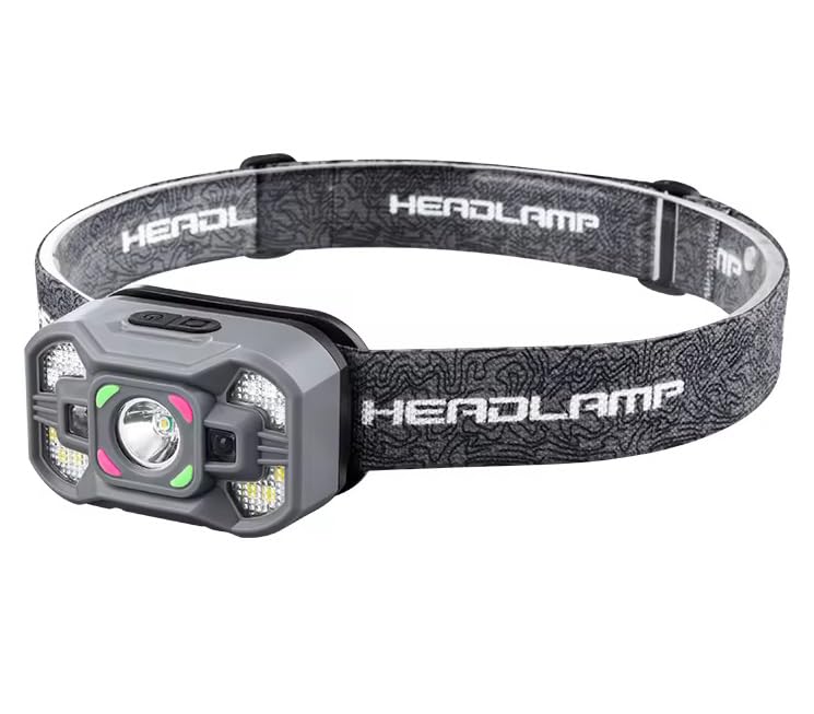
- ✅Hands-Free: Essential for early morning treks (3 AM) so you can use trekking poles freely.
- ✅High Brightness: Powerful beam that covers up to 100 meters clearly.
- ✅Weatherproof: Continues to work even during rain or heavy mist.
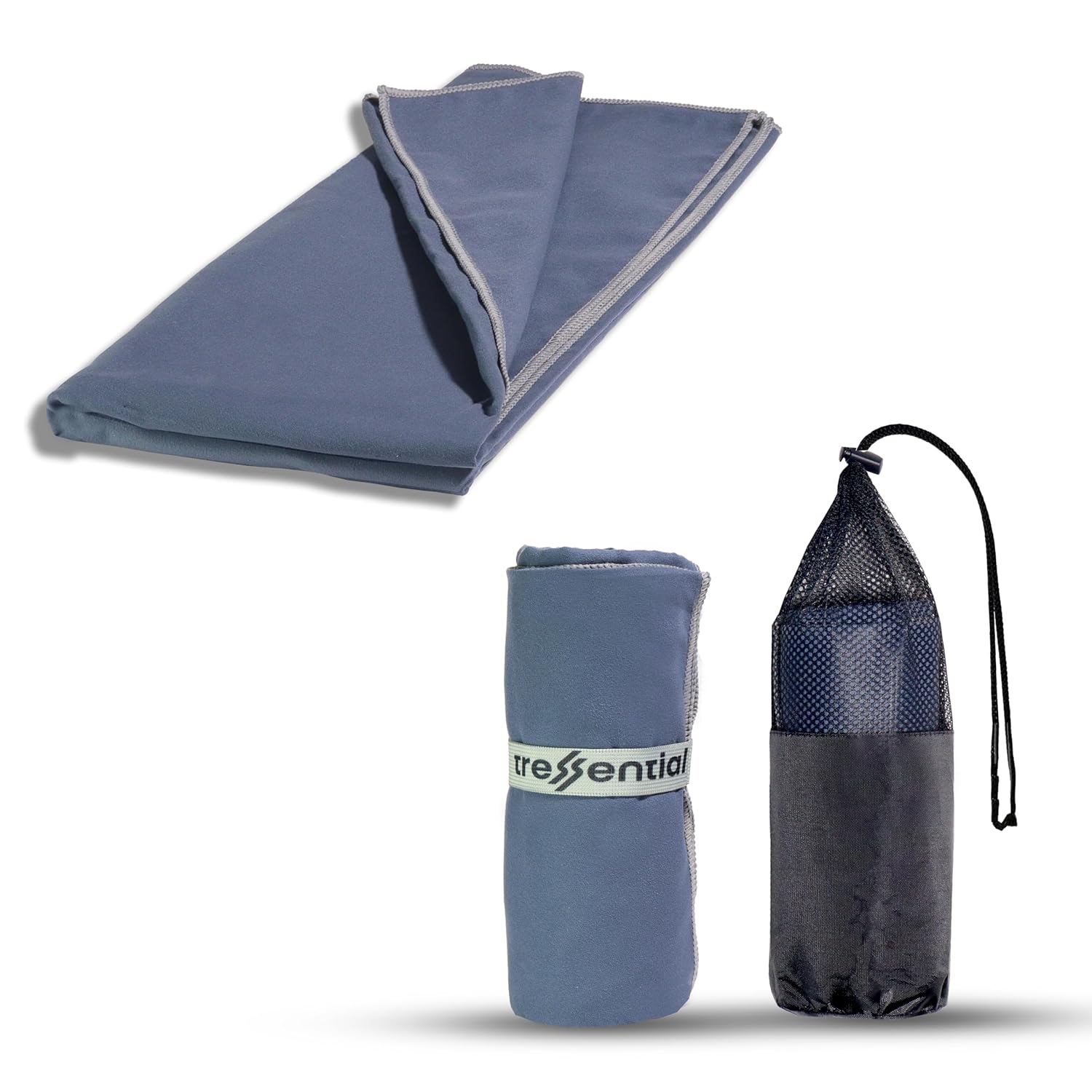
- ✅No Wet Smell: Dries in minutes so you don't carry a heavy, smelly towel in your bag.
- ✅Super Tiny: Folds into a small pouch, leaving more room for warm clothes.
- ✅Gentle: Ultra-soft fabric that is perfect for cold weather skin care.

- ✅High Altitude Protection: Himalayan sun is harsh and causes severe tanning & burns.
- ✅Non-Greasy: Doesn't feel oily while trekking or sweating.
- ✅Sweat Resistant: Stays on your skin even during high-intensity walking.

- ✅Dual Protection: Ponchos are good, but this ensures no water enters your bag.
- ✅Reflective Logo: Helps others see you in heavy mist or night treks.
- ✅Universal Fit: Fits perfectly on all 30L to 60L trekking backpacks.
Find premium travel gear, smart gadgets, luggage, power banks, travel organizers, and adventure equipment. Everything you need for a hassle-free trip in one place.
