
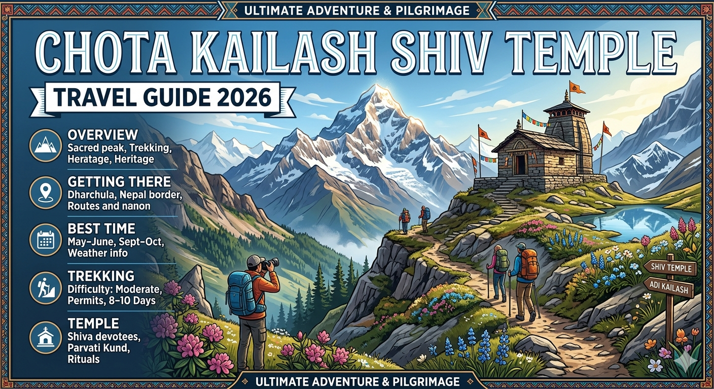
Nestled deep within the majestic Kumaon Himalayas of the Pithoragarh district in Uttarakhand, the sacred Chota Kailash Shiv Temple (frequently revered as Adi Kailash or Baba Kailash) stands as a profound testament to raw devotion and ethereal natural beauty. Perched near the Indo-Tibet border at an altitude approaching 4,750 meters (15,584 feet) at its base camp, this spiritual sanctuary offers an unparalleled alternative to the arduous trans-border Kailash Mansarovar Yatra. For global travelers and spiritual seekers planning a journey through the offbeat places in Uttarakhand, this comprehensive manual serves as your definitive roadmap for Chopta tourism 2026.
To ensure your journey across India’s holy circuits is seamlessly planned, you can explore detailed itineraries, custom packages, and expert safety checklists curated explicitly by the Dream Trip Guide.
The Spiritual Legacy of Chota Kailash
In Hindu mythology, Chota Kailash holds immense cosmological importance as the pristine, earthly abode of the Shiva-Parvati Parivar before their permanent settlement at Mount Kailash. The snow-clad summit, soaring to a towering chandrashila peak height of 6,191 meters (20,312 feet) in its broader geography, naturally mirrors the structural anatomy of the Tibetan Mount Kailash.
Right at its foothills lies the mystical Parvati Kund (also known as Parvati Tal), whose glassy, emerald waters perfectly mirror the snow-crested mountain peak. A short, high-altitude trek of 2 kilometers further uphill guides pilgrims to Gauri Kund, nestled closely at the absolute base of the mountain at an elevation of 5,245 meters.
Detailed Route Map and Distance Logistics
Modern infrastructure developments have vastly altered the structural access to this high-altitude sanctuary. Previously demanding a grueling 200 km trek, the journey is now primarily motorable up to the base camp areas, utilizing specialized 4×4 vehicles.
Core Journey Route Breakdown
| From | To | Distance (Approx.) | Mode of Travel / Key Highlights |
| Delhi | Kathgodam | 300 km | Overnight train or national highway road trip. |
| Kathgodam | Pithoragarh | 205 km | Hill highway drive via Bhimtal and Almora (7–8 hours). |
| Pithoragarh | Dharchula | 95 km | Winding mountain roads along the scenic Kali River (3 hours). |
| Dharchula | Gunji / Nabi | 72 km | Rugged border terrain via Tawaghat; mandatory Inner Line Permit check. |
| Gunji | Jolingkong Base Camp | 30 km | High-altitude mountain terrain road (Accessible via local 4×4 Bolero). |
| Jolingkong | Chota Kailash Temple | 2–3 km | Foot trek alongside the peaceful margins of Parvati Kund. |
Step-by-Step Travel Itinerary for 2026
To experience the full magnitude of this region safely while managing high-altitude acclimatization, a structured 7-to-9-day itinerary is strongly advised.
1.Arrival & Transit to the Kumaon Foothills:Day 1–2: Delhi to Pithoragarh.
Begin your road trip from Delhi, driving 300 km to Kathgodam. From there, traverse the scenic, winding switchbacks of the Kumaon hills for 205 km to reach Pithoragarh. Rest overnight to prepare your body for the mountain gradients ahead.
2.Acclimatization & Administrative Clearances:Day 3: Pithoragarh to Dharchula.
Drive 95 km (approx. 3 hours) alongside the thunderous Kali River to the border town of Dharchula. Utilize this vital stopover to secure or verify your mandatory Inner Line Permit (ILP) and clear mandatory medical screenings.
3.Ascent to the High-Altitude Border Outpost:Day 4: Dharchula to Gunji / Nabi Village.
Traverse a highly dramatic 72 km cliffside road cutting through the gorges of Tawaghat and Budhi to reach Gunji (3,220 meters). This culturally distinct village serves as the centralized hub for both the Chota Kailash and Om Parvat routes.
4.The Sacred Darshan at Chota Kailash Temple:Day 5: Gunji to Jolingkong & Chota Kailash Peak.
Depart before dawn via a 4×4 vehicle to reach Jolingkong Base Camp (4,750 meters), passing the historic ruins of the Pandav Fort near Kuti Village. Embark on a sublime 3 km trek to the Chota Kailash Shiv Temple and perform holy rituals at Parvati Kund. Return to Gunji for an overnight stay.
5.Witnessing the Mystical Om Parvat:Day 6: Gunji to Nabidhang & Return to Dharchula.
Drive towards Nabidhang (4,300 meters) to view the jaw-dropping, naturally formed “OM” symbol etched out of snow on Om Parvat. After capturing your chopta photos, begin the long descent back down to the lower altitudes of Dharchula.
Crucial Travel Checklist & Safety Tips
High-altitude environments mandate thorough logistical preparation. Ensure you check off every item before departing:
- Mandatory Documentation: A government-issued photo ID (Aadhar Card/Voter ID), physical fitness certificates issued by certified medical practitioners, and passport-sized photographs are compulsory for the Inner Line Permit.
- Acute Mountain Sickness (AMS) Protocol: The transition from lower plains to altitudes above 14,000 feet introduces thinner air. Climb slowly, restrict alcohol and caffeine intake, and maintain hydration by consuming 3–4 liters of water daily. Keep emergency supplies of Acetazolamide (Diamox) handy.
- Layered Technical Clothing: High-altitude mountain ridges drop to freezing temperatures instantly. Pack heavy thermal base layers, down jackets capable of enduring sub-zero climates (-5°C to -10°C), waterproof trekking pants, and sturdy, high-traction trekking boots.
Best Time to Visit and Weather Dynamics
The travel window for the high-altitude Kumaon border tracking circuit is strictly dictated by seasonal transitions:
- Summer Season (May to June): This is universally acknowledged as the best time to visit Chopta and the Chota Kailash valley. Daytime temperatures hover between a comfortable 12°C and 20°C, providing crisp, unclouded views of the towering snow peaks.
- Autumn Season (September to October): Post-monsoon, the mountain landscapes clear dramatically, unveiling vibrant alpine colors and crisp blue skies.
- Monsoon Intermission (July to August): Travel is strongly discouraged during these months due to a high vulnerability to sudden cloudbursts, severe flash floods, and blocking landslides along the cliff roads.
Frequently Asked Questions (FAQs)
What is the exact altitude of Chota Kailash Temple?
The temple and its accompanying Parvati Sarovar sit at an approximate altitude of 4,501 meters (14,767 feet) above sea level, while the immediate base camp at Jolingkong rests at 4,750 meters. The geographical peak itself reaches a height of 6,191 meters.
Is an Inner Line Permit mandatory for this tour?
Yes. Because the entire route runs closely parallel to the sensitive Indo-Tibet and Indo-Nepal international borders, every traveler must obtain a valid Inner Line Permit issued by the Sub-Divisional Magistrate (SDM) office in Dharchula.
Can the entire Chota Kailash Yatra be completed without trekking?
With recent road constructions completed by the Border Roads Organisation, sturdy 4×4 SUVs can drive you directly from Dharchula up to Jolingkong Base Camp. From the base camp, only a minimal, flat walk of 2 to 3 kilometers is required to reach the main temple shrine.
How does this pilgrimage compare to the standard Chopta Chandrashila circuit?
While the Chopta Tungnath Chandrashila trek in the Garhwal region is a shorter weekend trip reaching the highest Shiva temple globally at a modest altitude, the Chota Kailash Yatra in Pithoragarh is an extensive, multi-day, high-altitude border expedition that demands superior physical endurance.
Embark on Your Divine Journey
The Chota Kailash Shiv Temple is far more than a physical travel destination; it is a profound transformative experience that challenges your limits and rewards your soul with unparalleled peace. Plan your comprehensive travel itinerary, view verified transit route maps, and book custom curated packages via the Dream Trip Guide to discover the true magic hidden within the Indian Himalayas.
Email: dreamtripguides@gmail.com
Best Bike Travel Accessories & Riding Gadgets Guide
🏔️ Kedarnath Yatra Checklist 2026: 12 Must-Have Items for a Successful Trek

- ✅Altitude Protection: Prevents breathlessness and headaches caused by low oxygen levels at Kedarnath top.
- ✅Instant Energy: Helps you recover faster during the steep 16km trek from Gauri Kund.
- ✅Lightweight: Fits easily in your side pocket and weighs almost nothing.

- ✅Unbeatable Grip: Anti-skid soles designed specifically for slippery mountain rocks and mud.
- ✅100% Waterproof: Keeps your feet dry during sudden rains or while crossing small streams.
- ✅Ankle Support: Prevents injuries on the uneven zig-zag paths of the Kedar valley.

- ✅Total Coverage: Covers you and your large backpack completely during heavy mountain rains.
- ✅Quick Dry: Much better than heavy raincoats; it's light and dries in minutes.
- ✅Windproof: Blocks the freezing cold winds that follow the rain at high altitudes.

- ✅Heat Retention: Advanced fabric that locks body heat even when the temperature drops to 0°C.
- ✅Odour Resistant: Can be worn for multiple days without feeling unhygienic.
- ✅Slim Fit: Fits comfortably under your regular clothes without looking bulky.

- ✅Cold Protection: Battery dies fast in cold weather; this ensures your phone stays alive for photos.
- ✅Massive Capacity: Charge your phone and camera 4-5 times fully during the trip.
- ✅Fast Charging: Don't waste time at charging points in tea stalls.

- ✅Knee Support: Reduces 25% of the pressure on your knees during the steep descent.
- ✅Better Balance: Essential for crossing slippery patches or walking in narrow trails.
- ✅Anti-Shock: Absorbs ground impact to prevent wrist and shoulder pain.

- ✅12H Hot: Keep hot water/tea ready to fight the freezing cold of the Himalayas.
- ✅BPA Free: Safe and healthy stainless steel that won't rust.
- ✅Strong Body: Survives accidental drops on rocky terrains easily.

- ✅Mountain Ready: Contains pain sprays, bandages, and altitude sickness tablets.
- ✅Lightweight: Small enough to fit in any backpack side pocket.
- ✅Must Have: Medical help is far away on the trek; be your own first responder.
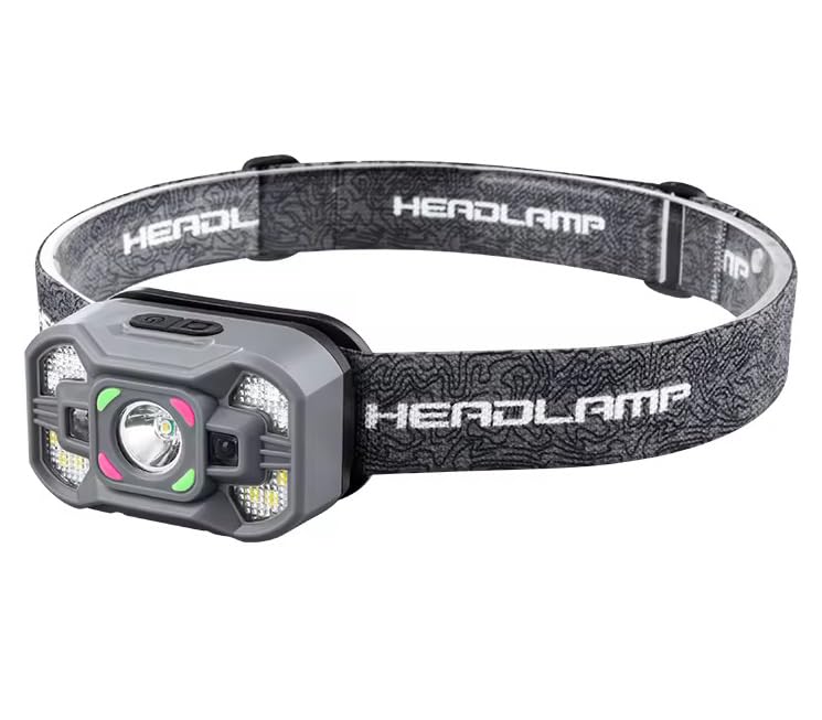
- ✅Hands-Free: Essential for early morning treks (3 AM) so you can use trekking poles freely.
- ✅High Brightness: Powerful beam that covers up to 100 meters clearly.
- ✅Weatherproof: Continues to work even during rain or heavy mist.
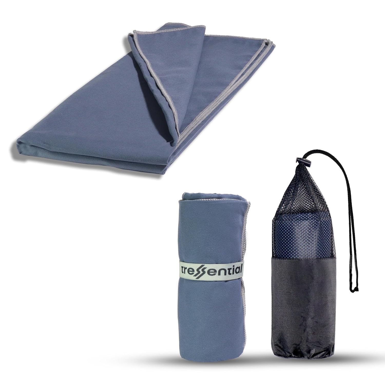
- ✅No Wet Smell: Dries in minutes so you don't carry a heavy, smelly towel in your bag.
- ✅Super Tiny: Folds into a small pouch, leaving more room for warm clothes.
- ✅Gentle: Ultra-soft fabric that is perfect for cold weather skin care.

- ✅High Altitude Protection: Himalayan sun is harsh and causes severe tanning & burns.
- ✅Non-Greasy: Doesn't feel oily while trekking or sweating.
- ✅Sweat Resistant: Stays on your skin even during high-intensity walking.

- ✅Dual Protection: Ponchos are good, but this ensures no water enters your bag.
- ✅Reflective Logo: Helps others see you in heavy mist or night treks.
- ✅Universal Fit: Fits perfectly on all 30L to 60L trekking backpacks.
Explore the best bike travel accessories like helmet cameras, mobile holders, waterproof bags, riding gloves, Bluetooth helmets, air pumps, and GPS trackers for long road trips. These essential riding gadgets improve safety, comfort, navigation, and storage for solo riders, adventure bikers, and motorcycle travelers exploring mountains, highways, and off-road destinations.
