
Executing a high-altitude road expedition through the soaring ridges of the Garhwal Himalayas requires precision, thorough safety mapping, and trusted geographical intelligence. For global adventurers and domestic road-trippers using a definitive trip planning guide to build out an unforgettable mountain escape, linking the profound spiritual power of Kedarnath with the untouched alpine meadows of the chopta valley represents the ultimate driving circuit.
This comprehensive, publication-grade manual serves as your premier online travel guide blog resource. It details verified travel distances, high elevations, exact route timelines, and local safety rules for a seamless 5-day mountain road trip beginning in Haridwar or Rishikesh and ascending to the majestic heights of the chandrashila trek.
The Master 5-Day Road Trip Itinerary
To safely balance long hours of mountain driving with strenuous high-altitude trekking, your itinerary must follow a clear chronological sequence. This layout is specifically designed to allow for gradual acclimatization while making the absolute most of your time at key wilderness locations Kedarnath Package.
1.Day 1: Haridwar to Sonprayag via Rishikesh Driving Corridor:Distance: ~210 km (130.5 miles) | Drive Time: 7-8 Hours.
Depart early from Haridwar on National Highway 34 (NH-34), quickly picking up the main rishikesh to chopta highway system (NH-7). Wind alongside the massive, roaring confluences of the Alaknanda and Mandakini rivers, passing through Devprayag and Rudraprayag. Arrive at Sonprayag or Guptkashi by late afternoon to complete biometric clearances and settle in for an early night.
2.Day 2: High-Altitude Trek Ascent from Gaurikund to Kedarnath:Trek Distance: 16 km (9.9 miles) | Elevation Gain: ~1,900 meters.
Take a short, local shared transit vehicle from Sonprayag to the Gaurikund trailhead. Begin the engineered mountain climb up to the sacred temple. Keep a slow, steady, and rhythmic pace to ease your breathing as the air thins. Reach the sacred base camp by afternoon, witness the powerful evening temple ceremonies, and stay overnight in a local guest house.
3.Day 3: Kedarnath Descent and Mountain Drive to Chopta Hill Station:Trek Descent: 16 km | Driving Distance: ~95 km (59 miles).
Hike back down the mountain trail from Kedarnath to Gaurikund during the crisp early morning hours. Reconnect with your vehicle at Sonprayag to tackle the beautiful chopta to Kedarnath distance route via Ukhimath. Arrive by evening at the expansive alpine meadows of chopta hill station to settle into your high-mountain campsites or eco-lodges.
4.Day 4: The Unified Chopta Tungnath Chandrashila Summit Bid:Trek Loop: 10 km (6.2 miles) | Maximum Altitude: 4,000 meters.
Launch an early morning climb from the main trailhead in Chopta. Trek through the pristine forests of the Kedarnath Wildlife Sanctuary to reach the ancient Tungnath Temple. From there, complete the steep rocky scramble to the Chandrashila summit. Take in the panoramic views, descend back to Chopta, and make the short 50-minute drive down to Sari Village for the night.
5.Day 5: Deoria Tal Exploration and Return Journey to Haridwar:Lake Trek: 2.5 km (1.5 miles) | Return Drive: ~200 km (124 miles).
Complete a quick sunrise hike up to the emerald waters of Deoria Tal to see the towering Chaukhamba peaks mirrored perfectly on its surface. Return to Sari Village for a hearty breakfast, pack your gear, and drive down through the scenic chopta to rishikesh distance canyon corridor, arriving back in Haridwar by late evening.
🏔️ Kedarnath Yatra Checklist 2026: 12 Must-Have Items for a Successful Trek

- ✅Altitude Protection: Prevents breathlessness and headaches caused by low oxygen levels at Kedarnath top.
- ✅Instant Energy: Helps you recover faster during the steep 16km trek from Gauri Kund.
- ✅Lightweight: Fits easily in your side pocket and weighs almost nothing.

- ✅Unbeatable Grip: Anti-skid soles designed specifically for slippery mountain rocks and mud.
- ✅100% Waterproof: Keeps your feet dry during sudden rains or while crossing small streams.
- ✅Ankle Support: Prevents injuries on the uneven zig-zag paths of the Kedar valley.

- ✅Total Coverage: Covers you and your large backpack completely during heavy mountain rains.
- ✅Quick Dry: Much better than heavy raincoats; it's light and dries in minutes.
- ✅Windproof: Blocks the freezing cold winds that follow the rain at high altitudes.

- ✅Heat Retention: Advanced fabric that locks body heat even when the temperature drops to 0°C.
- ✅Odour Resistant: Can be worn for multiple days without feeling unhygienic.
- ✅Slim Fit: Fits comfortably under your regular clothes without looking bulky.

- ✅Cold Protection: Battery dies fast in cold weather; this ensures your phone stays alive for photos.
- ✅Massive Capacity: Charge your phone and camera 4-5 times fully during the trip.
- ✅Fast Charging: Don't waste time at charging points in tea stalls.

- ✅Knee Support: Reduces 25% of the pressure on your knees during the steep descent.
- ✅Better Balance: Essential for crossing slippery patches or walking in narrow trails.
- ✅Anti-Shock: Absorbs ground impact to prevent wrist and shoulder pain.

- ✅12H Hot: Keep hot water/tea ready to fight the freezing cold of the Himalayas.
- ✅BPA Free: Safe and healthy stainless steel that won't rust.
- ✅Strong Body: Survives accidental drops on rocky terrains easily.

- ✅Mountain Ready: Contains pain sprays, bandages, and altitude sickness tablets.
- ✅Lightweight: Small enough to fit in any backpack side pocket.
- ✅Must Have: Medical help is far away on the trek; be your own first responder.
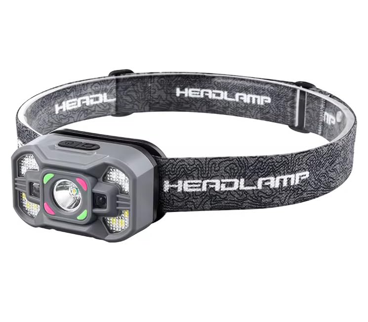
- ✅Hands-Free: Essential for early morning treks (3 AM) so you can use trekking poles freely.
- ✅High Brightness: Powerful beam that covers up to 100 meters clearly.
- ✅Weatherproof: Continues to work even during rain or heavy mist.
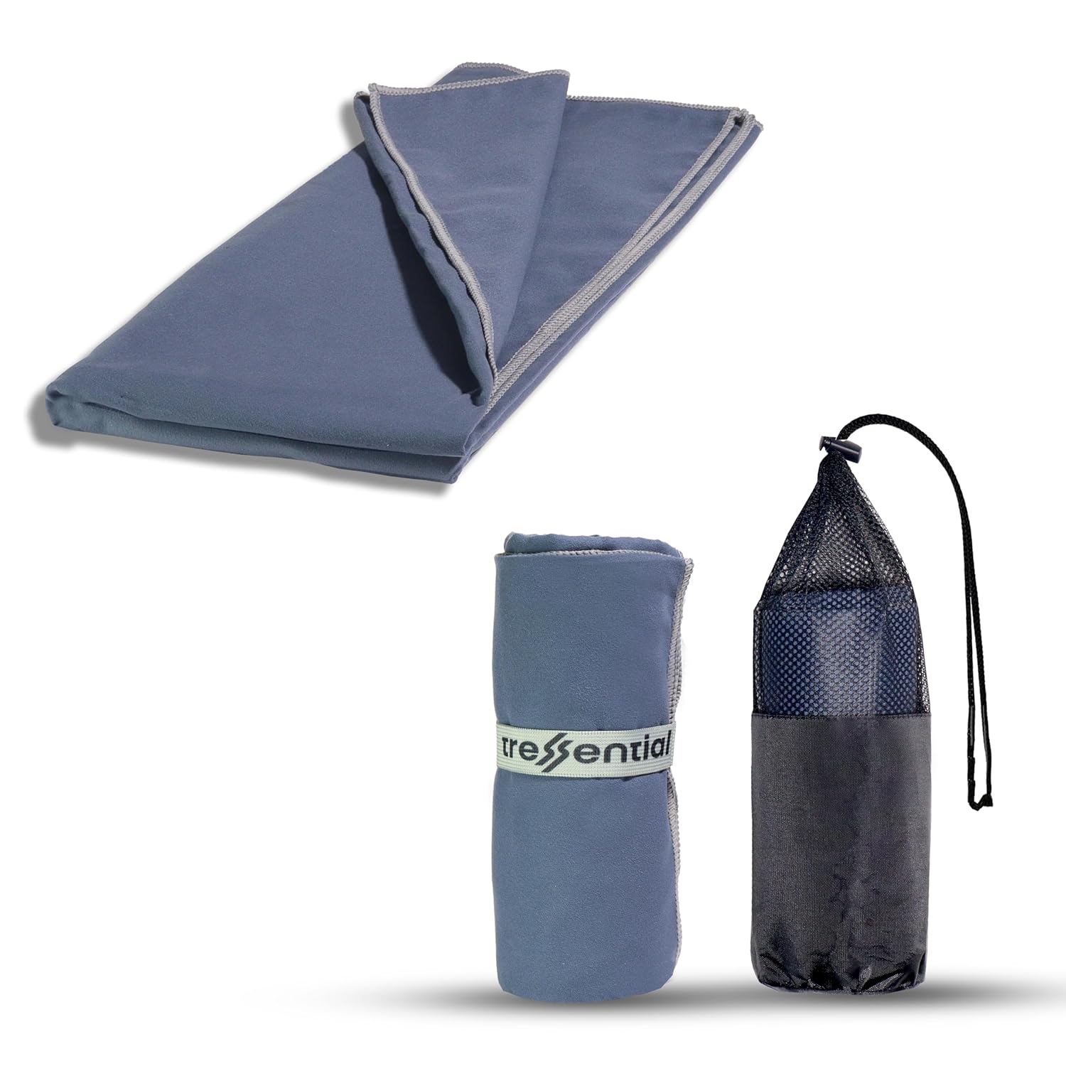
- ✅No Wet Smell: Dries in minutes so you don't carry a heavy, smelly towel in your bag.
- ✅Super Tiny: Folds into a small pouch, leaving more room for warm clothes.
- ✅Gentle: Ultra-soft fabric that is perfect for cold weather skin care.

- ✅High Altitude Protection: Himalayan sun is harsh and causes severe tanning & burns.
- ✅Non-Greasy: Doesn't feel oily while trekking or sweating.
- ✅Sweat Resistant: Stays on your skin even during high-intensity walking.

- ✅Dual Protection: Ponchos are good, but this ensures no water enters your bag.
- ✅Reflective Logo: Helps others see you in heavy mist or night treks.
- ✅Universal Fit: Fits perfectly on all 30L to 60L trekking backpacks.
Regional Topography & High-Altitude Metrics
Successfully managing a road trip across the Chopta Uttarakhand travel guide highway network requires clear, undeniable geographical data. Ensure these essential elevation points and trail benchmarks are packed into your ultimate travel guide toolkit:
| Geographic Landmark / Node | Absolute Metric Altitude | Strategic Road & Trekking Context |
| Chopta Height & Altitude | 2,680 m / 8,790 ft | The principal base camp for local eco-tourism forest camping and hotels. |
| Tungnath Altitude | 3,680 m / 12,073 ft | The highest historic stone temple dedicated to Lord Shiva on Earth. |
| Chandrashila Peak Height | 4,000 m / 13,123 ft | A spectacular rocky summit providing a 360-degree look at the Garhwal range. |
| Chopta to Tungnath Distance | 3.5 km / 2.1 miles | A wide, beautifully stone-paved trail ascending gently through native forests. |
| Tungnath to Chandrashila Distance | 1.5 km / 0.9 miles | A steep, exposed gravel and dirt ridge line requiring high-grip hiking boots. |
| Deoria Tal Trek Distance | 2.5 km / 1.5 miles | A gentle forest walk starting from Sari Village that leads to an alpine lake. |
Chopta: The Alpine Masterpiece of Uttarakhand
Known across the globe by adventure travelers as the mini Switzerland in Uttarakhand (and the mini Switzerland of Uttarakhand), the gorgeous chopta valley offers an incredible escape into raw nature. Shrouded by old-growth forests of oak, pine, and native rhododendron, it provides a quiet sanctuary from the busier tourist trails.
The Chopta Trekking Guide
The heart of any visit to chopta mini Switzerland is the iconic chopta chandrashila trek. The journey begins right from the main paved road marker in Chopta, making it highly accessible for an independent solo trip to Chopta, an adventurous chopta couple trip, or a structured chopta family trip.
If you visit chopta in summer (April to June), the weather is perfectly crisp and the entire forest canopy bursts into a sea of red and crimson rhododendron blossoms. The trail up to the tungnath mandir trek milestone is broad and fully paved with stone steps, reducing technical difficulty while keeping the climb steady.
Reaching the Chandrashila Peak View
Beyond the ancient stone walls of Tungnath Temple, the trail transitions into a rugged mountain scramble. The final tungnath to chandrashila trek distance spans 1.5 km of steep, rocky switchbacks. For those undertaking an adventurous night chandrashila trek to catch the sunrise, this stretch demands your full attention and high-lumen headlamps.
Standing atop chandrashila peak, the ultimate reward is a brilliant, unobstructed chandrashila view. The summit offers a spectacular panoramic look at the massive snow-capped peaks of Chaukhamba, Nanda Devi, Trishul, Kedarnath, and Kedar Dome piercing the sky.
The Deoria Tal & Side Trail Integration
To turn your trip into the ultimate multi-day adventure, your itinerary should always pair the main peaks with the chandrashila deoriatal trek combination.
Located just an hour’s drive down the valley near the quiet village of Sari, the deoria tal trek leads to an emerald-green lake hidden deep within a protected forest. Siting at an elevation of 2,438 meters (7,998 feet), the lake acts as a massive natural mirror, reflecting the multi-peaked Chaukhamba mountain massif perfectly on its calm, glassy waters.
- Trek Dynamics: This 2.5 km walk serves as a fantastic, low-impact warm-up hike before tackling the thinner air of the chopta trek.
- The Full Route: Combining these trails into a unified deoriatal chandrashila trek itinerary gives you access to the finest wilderness photography spots and deep forest campsites in the region.
Travel Realities: Weather, Budgets, and Route Planning
Weather Anomalies & Seasonal Road Advice
- Summer Comforts (April to June): Expect clear driving conditions, excellent visibility, and daytime mountain temperatures ranging from 15°C to 24°C (59°F–75°F).
- The Winter Snowfall Guide (November to March): The region transforms into a dramatic winter wonderland. Heavy snow frequently closes down portions of the main roads between January and February. If planning an early winter road trip, focus your route along the ukhimath to chopta distance corridor, as the western mountain slopes facing Ukhimath are prioritized by local clearing crews when the eastern highway sections freeze.
Budget Architecture & Group Bookings
A classic chopta budget trip or independent backpacking holiday is highly cost-effective compared to Western mountain resorts. Clean local homestays, traditional meals, and basic trekking guides cost roughly $30 to $50 USD per day. For a more structured vacation, booking a pre-arranged tungnath trek package or an all-inclusive chopta tour package covers your high-altitude tents, experienced local guides, and all necessary transport clearances.
Frequently Asked Questions (FAQs)
What is the exact chopta to tungnath trek distance?
The dedicated foot trail from the main road base in Chopta up to the stone gates of Tungnath Temple is exactly 3.5 kilometers (2.1 miles). The path is wide and entirely paved with stone steps, making it highly accessible for families, beginners, and veteran trekkers alike.
Why is the Chopta valley regularly called the Mini Switzerland of Uttarakhand?
Chopta earned this iconic nickname due to its striking resemblance to classic Swiss alpine landscapes. It features vast, rolling green meadows (bughyals), dense pine and oak forests, crisp mountain air, and a sweeping backdrop of dramatic, snow-capped peaks.
Is the night chandrashila trek safe for a beginner hiker?
Yes, but it requires proper preparation. While the stone trail up to Tungnath is straightforward, the final 1.5 km ridge climb to Chandrashila Peak consists of steep switchbacks and loose rock. If climbing in the dark to catch the sunrise, always use a high-powered headlamp, carry reliable trekking poles, and consider hiring a local guide.
What is the driving distance from Chopta to Rishikesh?
The total road distance from Chopta to Rishikesh along the national highways is approximately 165 kilometers (102.5 miles). The mountain drive typically takes between 5.5 and 6.5 hours, depending on seasonal weather, traffic, and road conditions.
Can I drive directly from Chopta to Kedarnath?
You cannot drive directly across the high ridges separating them. You must drive down the mountain valleys from Chopta, pass through Ukhimath, and then drive up the next valley to Sonprayag/Gaurikund, covering a road distance of roughly 95 km (59 miles) over 4 to 5 hours.
- Direct Inquiries: dreamtripguides@gmail.com