
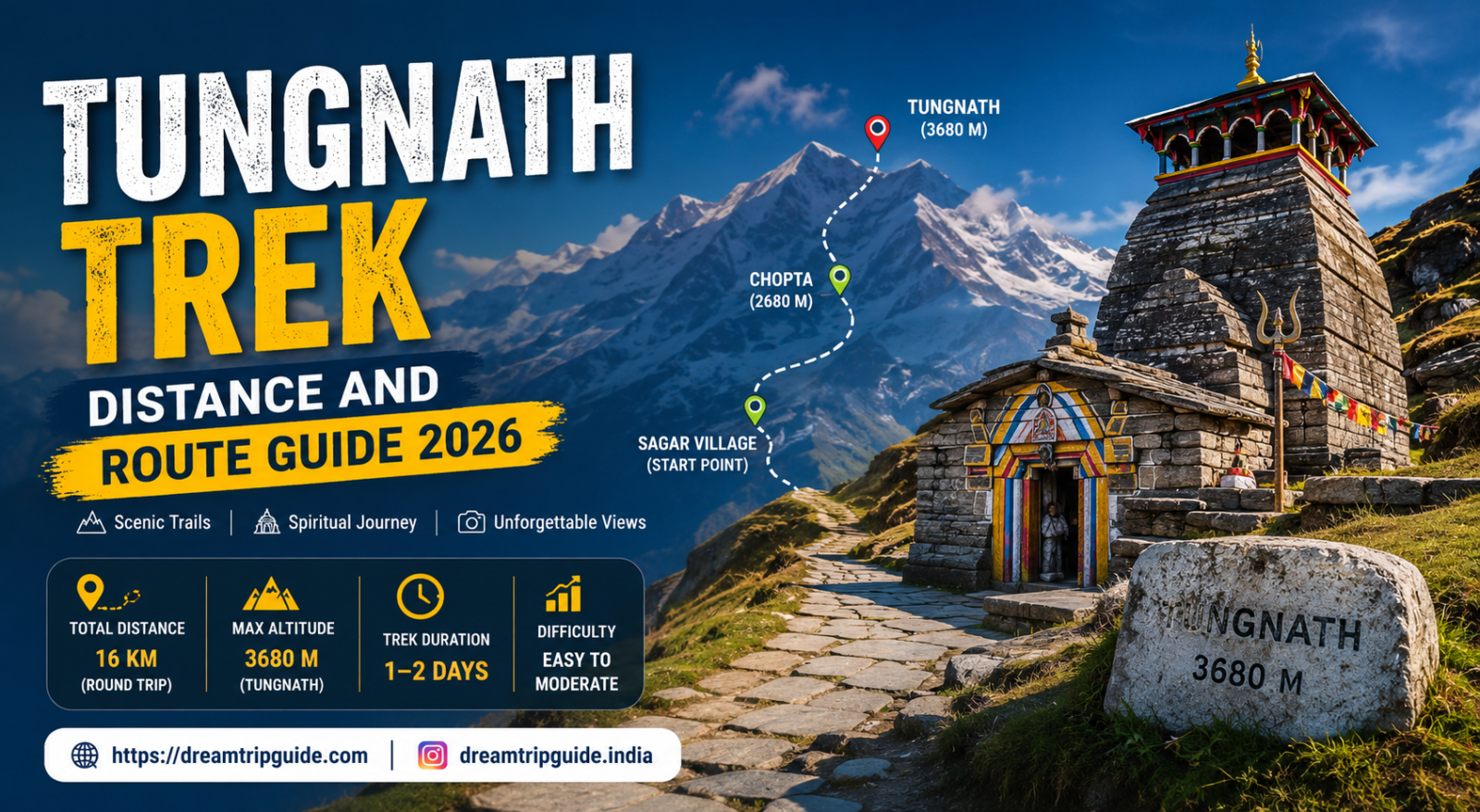
When it comes to experiencing the raw, mystical grandeur of the Indian Himalayas, few paths match the spiritual resonance and visual spectacle of the Chopta Tungnath trek. Tucked away in the scenic Rudraprayag district of Uttarakhand, this legendary trail leads adventurers and devotees alike to the Tungnath Mandir trek hub—the highest-known shrine dedicated to Lord Shiva anywhere on Earth.
Whether you are looking for an exhilarating Chopta Tungnath weekend trip, an immersive winter expedition, or a detailed Chopta Uttarakhand travel guide to map your route, this comprehensive guide provides everything you need. Updated for Chopta tourism 2026 with the latest on-ground details, real distances, transit infrastructure, and expert packing hacks, this is your blueprint for the perfect mountain trek.
Before diving into the detailed trail breakdowns, explore the overarching planning frameworks curated on our central travel platform at the Dream Trip Guide.
1. Quick Stats: Distance, Elevation, and Demographics
To build a flawless baseline for your Chopta travel itinerary, you must understand the geographical footprint of the trail. The accent climbs through the pristine Kedarnath Wildlife Sanctuary, demanding respect but remaining highly accessible compared to other major Uttarakhand trekking destinations.
| Parameter | Metric Measurement | Crucial Traveler Insights |
| Chopta Height (Base Camp) | 2,608 meters (~8,556 feet) | Meadows of oak and rhododendron forest lines. |
| Tungnath Altitude (Shrine) | 3,680 meters (~12,073 feet) | The highest of the revered Panch Kedar temples. |
| Chandrashila Peak Height | 4,000 meters (~13,123 feet) | The true summit, offering a 360° Himalayan view. |
| Chopta to Tungnath Trek Distance | 3.5 Kilometers (One-Way) | A fully stone-paved, well-defined mountain trail. |
| Tungnath to Chandrashila Distance | 1.5 Kilometers (One-Way) | A steep, unpaved, loose-gravel rocky crag. |
| Total Chandrashila Trek Distance | 5.0 Kilometers (One-Way) | Total push from Chopta base bazaar to the absolute summit. |
2. The Comprehensive Route Map Guide: Reaching the Base Camp
Getting to Chopta hill station, widely celebrated as the mini Switzerland of Uttarakhand, requires an scenic journey running deep alongside the holy Alaknanda and Mandakini river confluences.
                    [ Central Route Map Coordinates ]

  +------------------+       (165 km)       +-------------------+
  |    RISHIKESH     |=====================>|    RUDEAPRAGYAG   |
  |  (Nearest Rail)  |     (5-6 Hours)      | (River Confluence)|
  +------------------+                      +-------------------+
                                                      ||
                                                      || (34 km)
                                                      \/
  +------------------+       (24 km)        +-------------------+
  |      CHOPTA      |<=====================|     UKHIMATH      |
  |   (Base Camp)    |     (1.5 Hours)      |  (Winter Seat)    |
  +------------------+                      +-------------------+
Route Option 1: Delhi to Chopta (Overland Road Trip)
The absolute favorite for a quick Chopta weekend trip. The total Chopta distance from the national capital is roughly 410 kilometers.
- The Route: Delhi ➔ Haridwar ➔ Rishikesh ➔ Devprayag ➔ Srinagar ➔ Rudraprayag ➔ Ukhimath ➔ Chopta.
- Transit Tips: For an optimized Chopta road trip or Chopta bike trip, halt overnight at Rishikesh or Rudraprayag to safely tackle the high-altitude winding mountain turns the following morning.
Route Option 2: Public Transit Upgrades for 2026
If you are planning a Chopta budget trip, public transportation is easier than ever. A newly introduced direct state bus service connects Rudraprayag directly to Chopta daily, departing at 9:30 AM and reaching by 12:30 PM. For those starting further back, map out your rishikesh to chopta or chopta to rishikesh distance (approx. 165 km) via shared local Max cabs passing through Ukhimath.
Important Transit Distance Marker: The exact ukhimath to chopta distance stands at 24 kilometers. Ukhimath is historically critical as the winter seat where the symbolic idols of Lord Kedarnath and Tungnath are safely worshiped during intense winter months.
3. Step-by-Step Trail Guide: Chopta to Chandrashila Peak
The legendary Chopta Chandrashila trek is perfectly split into two distinct physical phases. Navigating them smoothly depends heavily on steady pacing and hydration.
Phase 1: The Chopta to Tungnath Trek
- Distance: 3.5 km | Time Required: 2 to 2.5 HoursStarting directly from the colorful archway at the Chopta bazaar, the stone-paved trail slowly snakes upward through dense forests of dark green deodar and bright pink rhododendrons. The incline is moderately steep but features well-placed benches and small wooden tea shacks every few hundred meters. As you gain elevation, keep an eye out for the vibrant Himalayan Monal bird flitting across the grassy clearings. The trail concludes dramatically as you stand before the ancient stone architecture of the world’s highest Shiva shrine.
Phase 2: The Push to the Chandrashila Summit
- Distance: 1.5 km | Time Required: 45 minutes to 1 HourThe journey from tungnath to chandrashila trek distance markers is entirely different from the paved path below. This section is a steep, rugged, and completely unpaved rocky scramble up the spine of the mountain. Due to the chandrashila altitude hitting a staggering 4,000 meters, wind speeds accelerate rapidly and oxygen levels drop noticeably.
<Sequence>
{/* Reason: Steps are sequential; attempting the Chandrashila summit climb without following these exact timing and safety milestones risks being caught in high-altitude mountain storms. */}
  <Step title="Check Local Weather Clearances" subtitle="At Tungnath Temple Gate">
    Before leaving the temple courtyard, assess wind speeds and cloud cover. If dark clouds are rolling in over the Chaukhamba range, delay or halt your summit attempt immediately.
  </Step>
  <Step title="Navigate the Loose Scree Crags" subtitle="First 800 Meters">
    Maintain three points of physical contact on the trail. Walk on large, anchored boulders rather than loose, gravelly scree to prevent slipping.
  </Step>
  <Step title="The Final Ridge Scramble" subtitle="Last 700 Meters">
    The trail narrows along a sharp ridge line. Move single file, match your breathing to your footsteps, and avoid stepping near the sheer drops on the left.
  </Step>
  <Step title="The Chandrashila Summit Reach" subtitle="Peak Arrival">
    Step onto the true summit rock next to the tiny Ganga temple. Absorb the uninterrupted, panoramic 360-degree views of Trishul, Nanda Devi, and Kedarnath peaks.
  </Step>
</Sequence>
4. Expanding Your Itinerary: The Deoria Tal Trek Combo
No true Himalayan trekking guide would cover this region without recommending the classic deoriatal chandrashila trek combo. Located a short drive away from the main road, the emerald lake of Deoria Tal trek offers a beautiful contrast to the high-altitude rocky peaks.
- The Trailhead: The trek kicks off from Sari Village, located approximately 20 km from Chopta.
- Deoria Tal Trek Distance: A short, crisp 2.3-kilometer walk up a stone-laid path through scenic farms.
- The Visual Payoff: On a clear, windless morning, the glass-like surface of Deoria Tal yields a flawless, mirror-like reflection of the massive Chaukhamba mountain massif. Combining this into a chandrashila deoriatal trek itinerary creates the ultimate 3-day weekend escape.
5. Accommodation, Camping, and Budgeting Architecture
Planning your spending and lodging for a Chopta adventure trip is highly straightforward because the region remains wonderfully offbeat and eco-conscious.
Lodging and Campgrounds
- Chopta Campsites & Forest Camping: True Chopta camping happens in designated alpine meadows around Duggalbitta and Baniyakund, just a few kilometers below the main trailhead. Expect to pay around ₹1,500 to ₹3,500 ($18 to $42) per night for a cozy alpine tent setup including home-cooked dinners and morning breakfasts.
- Chopta Hotels & Homestays: For traditional concrete rooms with attached bathrooms and running hot water, pick a local chopta homestay in Sari village or stay at a mid-range hotel in Baniyakund.
The Financial Blueprint (Chopta Tour Cost)
To unlock the most immersive deals, review our specialized collections and packages cataloged at the Dream Trip Guide Itineraries.
- The Solo Backpacking Budget: By utilizing local buses from Rishikesh, staying in shared dorms, and eating local mountain food, a solo trip to Chopta can easily run as a Chopta budget travel plan under ₹5,000 ($60) total.
- The Premium Package: A private Chopta couple trip or Chopta family trip utilizing a personal AC sedan driver, premium Swiss tents with heating facilities, and an expert local trekking guide averages around ₹12,000 to ₹18,000 ($145 to $215) per person.
6. Weather Dynamics: Selecting Your Best Time to Visit Chopta
- Chopta in Summer (April to June): Perfect clear blue skies with temperatures ranging from a comfortable 10°C to 25°C. This window aligns perfectly with the reopening of the sacred temple gates, which officially occurred on April 22, 2026. The trails are lined with vibrant, blooming rhododendrons.
- Chopta Monsoon Travel (July to August): The valley turns into an incredibly lush green paradise, but landslides along the Mandakini river highways pose severe transit risks.
- Chopta Winter & Snowfall Guide (December to March): The region transforms into a pristine, snow-blanketed fairyland. If you are planning a winter trek, carry specialized snow spikes, heavy down jackets, and waterproof gaiters to handle the deep snow along the upper trail.
Frequently Asked Questions (FAQs)
What is the absolute best time to visit Chopta for a snowfall experience?
To experience peak winter magic, plan your trip between January and February. During this time, the entire Chopta valley view point area and surrounding oak forests are covered in thick sheets of white snow, making it a dream destination for photography enthusiasts.
Can an absolute beginner complete the Chandrashila peak trek?
Yes. The initial 3.5 km Chopta to tungnath trek distance is entirely paved and highly manageable for beginners, children, and families with a basic level of physical fitness. Only the final 1.5 km scramble from the temple to the Chandrashila summit demands extra caution due to loose gravel, steep inclines, and thin air.
Is mobile internet network available along the Chopta trekking route?
Mobile connectivity is intermittent in this region. Jio and BSNL offer decent calling networks and basic data packages at the Chopta base camp and Baniyakund. However, as you climb past the Tungnath temple toward the Chandrashila summit, signals vanish almost entirely. Download your offline maps and route guides beforehand.
What are the top things to do in Chopta besides trekking?
Beyond trekking, Chopta is a world-class destination for high-altitude bird watching. It serves as home to over 240 species of rare birds, including the majestic Himalayan Monal and the Musk Deer at the nearby Kanchula Korak Sanctuary. It is also an exceptional spot for astrophotography under dark, unpolluted mountain skies.
Contact Information
- Brand Entity: Dream Trip Guide
- Corporate Address: India Based Online Travel Blog, Helping Travelers Explore India
- Official Correspondence: dreamtripguides@gmail.com
